
Looking east towards Yosemite Valley. Credit Internetpress, Google Earth, Airbus, and Landsat/Copernicus.
Top Yosemite National Park Experiences
Get ready to dive into the unforgettable wonders of Yosemite with our guide to the Top Yosemite National Park Experiences. From the majestic heights of Half Dome to the serene beauty of Lyell Canyon, this article will lead you to the park's most exciting and memory-making spots. Discover the adventure, fun, and awe that await you in every corner of this iconic national park! Here they are in no specific order.
Publish Date: August 06, 2024
Revision Date: March 05, 2025
Yosemite National Park Visitor's Guide is a Trademark.
Copyright © 2024 by Internetpress®
Map of the Top Park Experiences
This map provides a single view of all the top Yosemite National Park experiences, except for the High Sierra Camps. The camps are shown by a map in another article dedicated to the camps themselves (link is provided below). All eleven experiences are shown as red dots with an “X” in the center. The Mist Trail and Tioga Road experiences also appear as paths highlighted in a thick blue line with their endpoints labeled as “A” and “B.”
Here’s how to use the map: To zoom in and out, use the Plus/Minus zoom control at the lower left corner. To pan left/right or up/down, drag any point on the map. To view a list of the experiences, click the rectangle at the top left corner, and three items will appear with a checkmark to their left. To hide an item, clear a checkmark. To place an experience’s location at the center of the map, click on the downward pointing arrowhead located below the “All the Experiences” checkmark to view a list of all the experiences, and then click on one of the listed experiences. To view an enlarged map in another tab (window), click the broken rectangle at the upper right corner. To share the map, click on the triad of dots at the upper right corner.
If using a conventional computer keyboard, a list of keyboard shortcuts can be viewed by clicking on the label “Keyboard shortcuts” at the bottom right corner, but be aware that the actual link may be on the border of the map right below the label.
Half Dome

Half Dome is the name for a spectacularly large and dramatic rock formation, located at the eastern end of Yosemite Valley, and may be the most famous object in the park. It appears as a dome cut in half, because when viewed as a four sided formation, one side is a sheer face, while the other three sides are smooth and round. It rises about 4,800 feet from the valley floor. That’s about 0.90 of a mile (1.5 km), so it is a great subject for photographs. For more information, see our article on Half Dome.
El Capitan
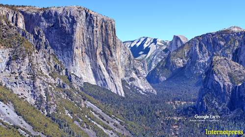
El Capitan is a very tall, and practically vertical, rock wall that is part of the wall that surrounds the Yosemite Valley. It rises about 3,000 feet (914 meters) from the valley floor to its top edge, and beyond its edge it continues to rise. It can be approached to within 1,600 feet (487 meters) with automobile, or you can use an un-named trail to walk directly to its base. Although it is not as recognizable as Half Dome, it is world famous among rock climbers, who appear as tiny specks on its surface. For more information, see our article on El Capitan.
Yosemite Falls
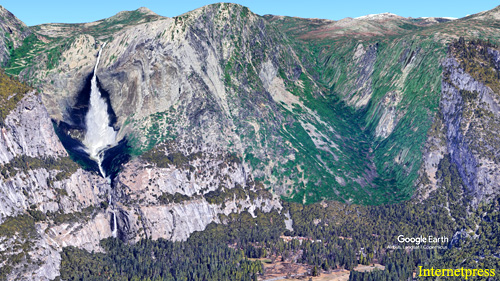
Yosemite Falls is one of the most iconic features of the park, and it is located at the eastern end of Yosemite Valley. It’s actually a series of three waterfalls: Upper Falls, Middle Cascades, and Lower Falls. Together, they create one of the tallest waterfalls in North America, with a total drop of about 2,425 feet (739 meters). The experience it provides is breathtaking views, easy accessibility from a road, a short and relatively flat trail that leads to a viewpoint. During spring and early summer, the falls are particularly powerful due to the snowmelt. In the fall, it can be a bit more delicate, but still beautiful. For more information, see our article on Yosemite Falls.
Bridalveil Falls
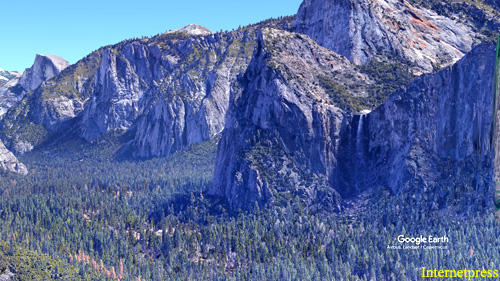
Bridalveil Falls is a stunning waterfall located at the western side of Yosemite Valley. It is one of the park's most famous waterfalls and is known for its impressive height and the way its mist creates a shimmering effect, resembling a bridal veil. The falls plunge about 620 feet (189 meters) from a granite cliff, making it one of the tallest waterfalls in the park. Like Yosemite Falls, the experience it provides is breathtaking views, easy accessibility from a road, a short and relatively flat trail that leads to a viewpoint. During spring and early summer, the falls are particularly powerful due to the snowmelt. And during the fall, it can be a bit more delicate, but still beautiful. For more information, see our article on Bridalveil Falls.
Mist Trail
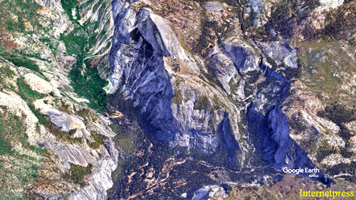
This trail is one of the most popular short hikes in the park, and is located at the east end of Yosemite Valley. The experience it provides is a wooded walk, into a canyon, along the Merced River, surrounded by giant granite rocks, to a couple of waterfalls, where the woods open up for views of Glacier Point to the west and a prominent granite dome to the north. The flow of the river reduces as the seasons move from spring to fall. The boulders have fallen off the valley walls. The first waterfall is Vernal, the second is Nevada, and the dome is named Liberty Cap that rises about 1,000 feet (304 meters) above and next to the river. From the trailhead, at Happy Isles Road to Vernal is about 0.8 mile (1.3 km), and to Nevada is about 1.56 miles (2.5 km). For more information, see our article on Mist Trail.
Merced River
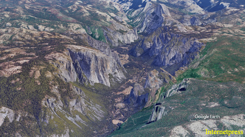
The Merced River is a significant river that flows through the entire length of Yosemite Valley. It is essential to Yosemite's ecology and is known for its scenic beauty. The experience it provides is viewing diverse wildlife, recreational opportunities such as picnicking, swimming, fishing, kayaking, and rafting. For more information, see our article on Merced River.
Mariposa Grove
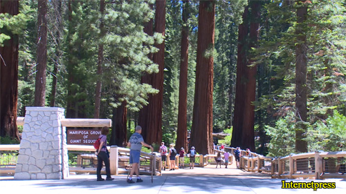
Mariposa Grove is a very unique and special forest which supports a variety of very large trees and diverse plant life. It is located right at the southern entrance of the park and about 35 miles (56 km) from Yosemite Valley. The experience it provides is to walk among its giant sequoia trees, some of which are thousands of years old and among the largest trees in the world. For more information, see our article on Mariposa Grove.
Lyell Canyon
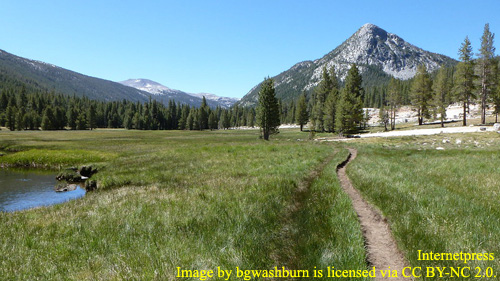
Lyell Canyon is a scenic, 8 mile long, valley, formed by the erosion and carving action of a glacier. It is located in the eastern part of the park, about 7 miles (11.3 km) west of the park’s eastern entrance, on Tioga Road, and about 60 miles (96.5) from Yosemite Valley. The experience it provides a relatively flat hike into stunning alpine scenery, including lush meadows, crystal-clear streams, and views of surrounding granite peaks, making it a popular destination for hikers and backpackers. For more information, see our article on Lyell Canyon.
Tuolumne Meadows
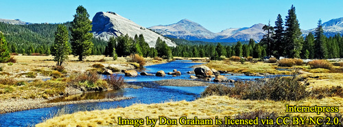
Tuolumne Meadows is a high-altitude meadow in Yosemite National Park, situated at about 8,600 feet (2.6 km) above sea level. It is located on Tioga Road, about 7.5 miles (12 km) from the eastern park entrance, and about 60 miles (96.5 km) from Yosemite Valley. It is the entrance to Lyell Canyon. The experience it provides is a serene, alpine area known for its expansive meadows, scenic views, and abundant wildflowers. The meadows are surrounded by mountain peaks, including the Cathedral Range, and offer numerous hiking trails, including the popular ones to Mono Pass and Soda Springs. It’s also a great spot for fishing, with several streams and small lakes. For more information, see our article on Tuolumne Meadows.
Tioga Road
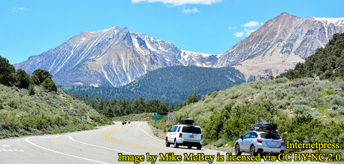
California State Highway 120 is a winding road that crosses the entire width of the park, at its center, from east to west. It has a fork at the western end of the park, where one path goes east to the other side of the park, and the other path goes south to Yosemite Valley. The path which goes to the eastern side of the park is Highway 120, also called Tioga Road. The Path which goes to Yosemite Valley is called Big Oak Flat Road. Tioga Road runs through Tuolumne Meadows and provides access to stunning high-country landscapes. The distance along Tioga from Big Oak Flat Road to the park’s eastern entrance is 46.5 miles (74.8 km). It is typically open from late June to October, depending on snow conditions. The experience it provides is several scenic viewpoints and easy access to many trailheads. For more information, see our article on Tioga Road.
Ahwahnee Hotel

The Ahwahnee is a luxury hotel, kept in its original 1920’s form, located at the east end of Yosemite Valley. Unless you are a hotel guest, the experiences it provides come from its pleasing “National Park Service Rustic” architecture and interior design, its facilities, and its views. The rustic design combines native wood and stone with convincingly native styles to create visually large and appealing structures that seem to fit naturally within the park landscape. The facilities are in the form of a restaurant and dining room, a bar, sweet shop, gift shop, and several lounges which are appointed with fireplaces and artwork. The views are of Half Dome, Glacier Point, and Yosemite Falls. For more information, see our article on the Ahwahnee Hotel.
Badger Pass Snow Ski Area
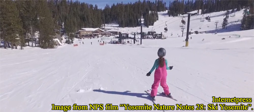
This is a small ski area located outside of and about three miles south the Yosemite Valley’s rim. From the Wawona Road Tunnel, at the western end of Yosemite Valley, it’s about a 14 mile drive by car to the area. It is only open during the snowy season, typically from mid-December to mid-March. The experience it provides are downhill and cross-country skiing, snow tubing, snowboarding, snowshoeing, and dining. For more information, see our article on Badger Pass Snow Ski Area.
Yosemite High Sierra Camps

The Yosemite High Sierra Camps are a series of remote campgrounds located in Yosemite National Park. These camps are situated in the high country of the park, providing access to some of the most scenic areas in Yosemite. They offer a more comfortable camping experience compared to traditional backcountry camping. For more information, see our article on Yosemite High Sierra Camps.
Glacier Point
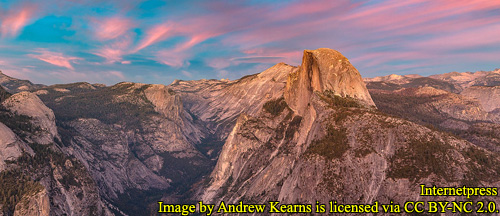
Glacier Point is a dramatic and memorable viewpoint. It is located on top of the valley rim, of the southern wall, at the east end of Yosemite Valley, at an elevation of 7,214 feet (2,199 m), and it is 3,200 feet (980 m) above the valley floor. It is almost a vertical drop from the point to the valley floor, very much like El Capitan. The point offers a superb view of several of Yosemite National Park's well-known landmarks, including Yosemite Valley, Yosemite Falls, Half Dome, Vernal Fall, Nevada Fall, and Clouds Rest. Between 1872 and 1968, it was the site of the Yosemite Firefall. For more information, see our article on Glacier Point.